Monday, October 10, 2016

Arches a la carte

Sunday morning I left Grand Canyon early, taking down my tent and hitting the road around 7:00 am. On my way out of the park the Fit passed 100,000 miles


I arrived in Moab early afternoon, and after a week of eating energy bars, pretzels and soup I hit the grocery store and fixed myself a big salad. Then I headed to Arches, but since the campground is at the far end of the park I made several stops en route to visit arches and other formations near the road.

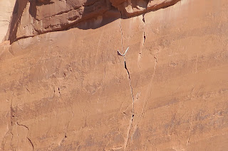
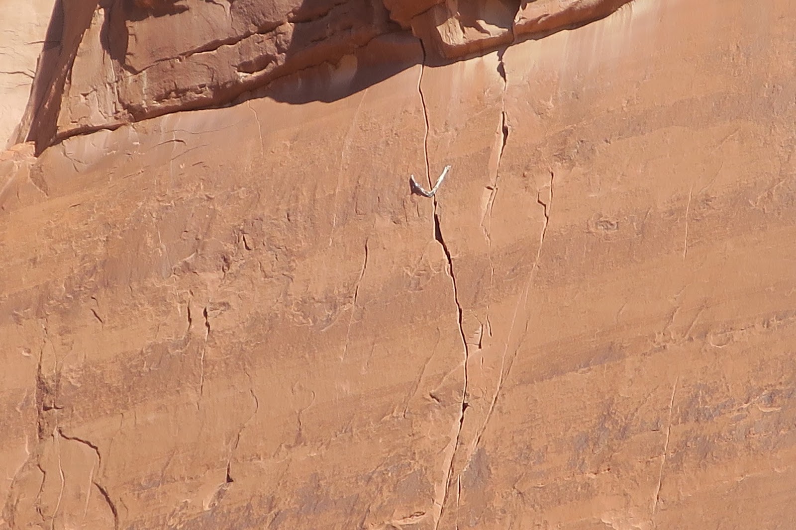
First stop was the Avenue, a 1 mile walk through sheer cliffs and spires.


While looking at the cliff above I noticed several climbing straps hanging from a crack route.


Then on to Balanced Rock, where I went for the 2001 A Space Odyssey "The Dawn of Man" shot.


Next up was the Windows


... and Double Arch


Really it's an embarrassment of riches. And in fact I skipped the park's iconic Delicate Arch, as I didn't want to do any uphill hiking after having trekked out of the Grand Canyon the previous day.

Once again I got a scenic campsite at Devil's Garden, but the level tent location at site #40 was a bit too close to the road and across from the restrooms. So it wasn't as nice or secluded as my previous spot, site #53. But it was pleasant making dinner in T-shirt weather -- and even nicer getting up to mild temperatures Monday morning. The drive back to Boulder was uneventful except for traffic jams due to construction on I-70 around Silverplume and Highway 93 north of Golden. Oh, and of course more road work in Pine Brook Hills, but this was worth it since a pint of Häagen-Dazs was waiting for me at home.

Saturday, October 8, 2016

Take me to the river

I didn't think I'd get all the way to the Colorado on this trip, but since my foot felt okay this morning and conditions were optimal (mild and overcast) I decided to go for it. After the usual hike down Bright Angel to Indian Garden I descended through the canyon's 1.7 billion year old "basement" rock.


Although the Vishnu schist is mostly gray the side canyon is greener than you might expect, due to runoff from the rim that drains into Pipe creek.


A pair of nice little waterfalls in Pipe creek. This would be a good place to cool off on the hike out


Looking down on a Colorado river beach from River Rest house.


Yes the beach on the far side looks inviting, but NPS warns hikers not to wade or swim in the swift currents of the Colorado.


Here's the clear water of Pipe creek entering the muddy Colorado.


And some small rapids to give the rafters something to talk about. On the Rim hike I learned that most of these rapids are due to slides from the side canyons. For example in 1984 Monument creek flooded so severely that 9' diameter boulders rolled down a massive mudslide, creating new rapids.


See this is why the Colorado gets so muddy: inconsiderate hikers washing off their dusty feet!


Hike up was pretty quick, though at one point rangers closed the trail for 10 minutes while the AmeriCorps crew slid some big rocks into place. I reached the rim five and a half hours after starting the hike.


Friday, October 7, 2016

Rim trail to Hermit's Rest

I've walked this section of the Rim trail a couple times this week, so I wanted to share some photos. It is stunning terrain, featuring a number of promontories (called "points") that jut out into the canyon. These are very popular at sunrise and sunset, and while cars aren't allowed on the road you can reach these lookouts by a free shuttle bus, by bike or on foot. The shuttle is super convenient, as it connects to the Village shuttle.

Here's one of the points, not sure which one.


There are many wonderfully twisted spruce and pinyon trees on the rim. This one was in the running for most picturesque. Note the pair of ravens to the right of the tree. Ravens really like circling around the rim.


I think this shrub is cliff rose. Desert plants are amazing.


Trees don't get to move around much, so it's really important to pick a good location.


This is Hermit's Rest. As you can see the hermit is resting.


Da big loop

Since my Achilles tendon survived yesterday's descent to Plateau Point I figured it was up for a 13-mile loop hike I did last year: S. Kaibab trail from the Rim to the Tipoff, then the Tonto trail west to Indian Garden campground, and finally Bright Angel trail back up to the rim.


Turned out that I was right: this hike wasn't too much for my Achilles. It was a bit cool when I left the rim at 8:00 am, but by the time I dropped down 3 miles to Cedar Ridge it was warm enough to change into a T-shirt. Then down another mile or so to "Skeleton Point" and on to the Tipoff, where there's a stunning view of the muddy Colorado river about 2000' below. This is also the junction with the Tonto trail, which winds along the Plateau level of the canyon.

Last year when I did this hike it was over 80 degrees on the Tonto, so I needed to drink a lot of water. This year it was probably 65, very pleasant hiking weather. So I made good time while enjoying the 360 degree scenery. At Indian Garden I got some cool water and snacked on a Clif bar, then it was time to climb to the rim. This went really fast. In short order I was at 3 mile rest house, then the 1.5 mile rest house. Finally I hiked through the tunnel just below Kolb studio and reached the rim at 1:15 pm. Statisticians: the 13 mile hike took 5 hours and 15 minutes.

I know you're thinking that I must have taken a Vitamin Awesome this morning to have completed this challenging hike so quickly. But compared to the many Grand Canyon trail runners I am Granny with a walker. A couple days ago a trail runner ran from the south rim to the north rim and back in 5 hours and 55 minutes. So in roughly the same time I took to hike 13 miles he got in 42 miles.

Thursday, October 6, 2016

Into the abyss

For the past 3 days I've been "testing" my Achilles tendon by hiking down Bright Angel to 3 mile rest house, which is 2000 vertical feet below the rim. But last evening as I walked along the rim I could see flashlights 3000 feet down at Indian Garden campground, so I decided that it was time for me to take the plunge.

This morning (Thursday) I got to the Bright Angel trailhead at 7:30 am, and scampered down the trail. To go easy on my legs I tried being light on my feet, i.e. taking short fast steps instead of my usual big strides. I wound up reaching Indian Garden in about an hour and a half, and at 9:30 am I was overlooking the Colorado river from Plateau point:


One surprising thing near Plateau Point is a drinking fountain in the middle of the desert. Reminds me of a Far Side cartoon where two guys crawling across the desert find a fountain: "Hey, let it run for a while to see if it gets cool."


NPS keeps busy choppering supplies to Indian Garden.


It is a long slog to the Rim, but at least you can see where you are going.


Though of course you have to watch out for tarantulas!


Last year I hiked from the rim to Plateau point in 2.5 hours, then back up to the rim in 3 hours. This year the hike down took just 2 hours, and the hike up less than 2.5 hours. Imagine how fast I would be if there wasn't all this distracting scenery.

Tuesday, October 4, 2016

Grand Canyon grandness

I know this is a hiking blog, and I did get in a couple of hikes today at the Grand Canyon. But today's topic is not hiking but grandness. Somehow I think that the grandeur of the canyon affects people in a very positive way. What I notice at the Grand Canyon is that most things are way better than they need to be.

For example take the Rim trail. By all means if you get to the south rim, take this trail. As expected the route is spectacular and wheelchair accessible. But there is an unexpected extra: the "trail of time" where in roughly a mile hikers walk through 2 billion years of geologic history, followed by the (relatively) brief 6 million year period in which the canyon was created and subsequently inhabited by humans. The dozens of rock samples are amazing. And I finally understand the concept of the Grand Canyon supergroup.

Then there's the Bright Angel trail, which I've already hiked three times this week. It's a well designed "super highway" trail that can accommodate thousands of hikers and dozens of mules daily. Again there are extras. The 1.5 mile and 3 mile rest stops feature spectacular views, welcome shade huts and solar ventilated toilets -- and the water spigots dispense natural water from Roaring Springs. This cool, delicious water is available all along the Rim, and the park encourages use of refillable water bottles. Of course the trail requires ongoing maintenance, and for the past couple days I've watched a hardworking Americorps crew armed with trail tools: spades, rock bars, pick-mattocks, Pulaskis and Mcleods. They are in the Canyon for 9 days, then moving on to other projects.

Another example is the Market. Within walking distance of Mather campground the Market is a four-in-one store combining a surprisingly well stocked grocery, deli, camping equipment store (think mini REI) and souvenir shop. Markup at the grocery was unexpectedly low for the national park location. Some items such as ice cream were roughly double supermarket prices, but most items were only 20 to 50% higher. And a few items such as onions, mushrooms and potatoes were actually cheaper. The grocery had everything you would need to make a gourmet camping dinner: fresh fruit and vegetables, spices, rice, pasta, good bread, cheeses, even Brown Cow and Chobani yogurt. In fact I found all of the ingredients to make fresh hummus! And since this is Arizona there's also an extensive selection of liquor, wine and microbrews. The latter were a bargain since you can buy single bottles for about $1.50. I can't speak for the deli since I didn't try it, but they do make veggie sandwiches and even veggie breakfast sandwiches.

Lastly most people at the Grand Canyon are super friendly, both park employees and tourists. Hikers ask questions and sometimes make amusing comments. Today I noticed an Italian couple pointing at some mule poop on the Bright Angel trail. "Myoo-lay," the woman observed. "Orss?" asked her companion. "Ay don-kay," she replied. Near sunset I took a long walk on the Rim trail, and on the way back a woman named MacKenzie asked me if I had seen her parents. I wasn't sure but I offered her my phone to call them. She said,"It never occurred to me to borrow someone's phone. I'm just not used to people being kind. In Illinois people can be brutal. Here everyone is just so nice."

Obligatory hiking notes: my Rim trail walk took me from the Village east about 2 miles to Yapavi lookout, which I reached just in time for a spectacular sunset. Dusk lasted for the 45 minutes it took me to walk back, during which time a crescent moon and Venus shone in the darkening sky. Just amazing... and tonight the stars will be incredible.

Sunday, October 2, 2016

Devil's Garden

Arrived at Arches NP on Saturday around 5:00 pm. As I pulled in I could see several rainstorms a few miles apart. One was over the Devil's Garden campground, which got a good soaking. But 20 minutes later the rain was over and I was able to set up my tent. Site #53 was perfect.


Since I was tired from the drive I turned in early. Next morning I fixed breakfast including home roasted coffee, mmm-mmm good. Then I took down the tent and drove to Devil's Garden trailhead. I had planned to get in a short, quick hike before heading to the Grand Canyon. Well the hike was short but not quick, as I wound up hiking with a woman I met a half mile from the trailhead. Laura is a biologist from Aurora CO, who was in Moab for a century (100 mile) bike ride. She completed the ride the previous day, and was unwinding by doing a hike. She kept referring to herself as a "wimp" because she isn't a fast hiker, but then she mentioned that she's training for an Ironman triathlon in Cozumel. Some wimp!

Back to the hike, Devil's Garden is an unusual trail that traverses several rock fins. If you don't pay attention (and I wasn't) it's easy to lose the trail, but the tricky terrain is worth it as the arches are amazing. The first arch is the longest, Landscape arch.


Monday, August 15, 2016

Achilles heel

I spoke too soon when I said that my Achilles tendon was mostly better. The hike to Lion lakes (or at least the downhill slog) caused it to swell and become sore. So for now I'm on a hiatus from hiking, as I need to allow this injury to heal before I take off for the Grand Canyon in 6 weeks. Unfortunately tendons heal very slowly...

Saturday, August 13, 2016

Lion lakes

This may be the first time I've hiked to Lion lakes, which are in the Wild Basin region of RMNP. Previously I've hiked to nearby Thunder lake. The trail starts at the Wild Basin ranger station, following N St Vrain creek west up a gentle grade. At 1.8 miles the trail crosses Cony creek at Calypso Cascades, then at 2.6 miles it crosses Ouzel creek just below Ouzel falls. This 40' waterfall (sorry, no pix) is a popular day hike/picnic destination.

Early in the hike a chipmunk stopped by to say hello. He was so sociable that I had to shoo him away. I suspect that he was after my chocolate brownie Clif bar.


After the Lion lake/Thunder lake junction the trail gets steeper and passes through a spruce forest. The trail is well marked and easy to follow, so I really didn't need the teeter totter cairns.


Below Lion lake the trail levels off as it winds through a marshy meadow. All the vegetation was lush and green, with a few wildflowers and even one big mushroom near the trail.


Lion lake #1 is nearly 7 miles from the trailhead, and when I arrived the waters were calm and crystal clear. Postcard quality mountain peaks frame the lake. The orientation of these photos is: south (Tanima peak?), west (Mt Alice), north (Chiefs Head peak), and down (H2O).


A faint trail continues along the eastern side of  Lion lake #1, leading to Lion lake #2. Here the cairns were genuinely useful as there are several paths to the lake. Below the lake are some rivulets, a small sheltered snowbank, and the world's most relaxed marmot.


To reach Lion lake #2 I needed to bushwhack through some willows, but it was well worth the effort. The lake looks like a gemstone, and the south slope of Chiefs Head peak boasts many striking rock spires.


Heading back to the trailhead I saw a rather shy mule deer, who hid behind a tree before ambling away.


Even with the bushwhacking this was a moderate hike, 14.5 miles RT with 2900' elevation gain. Once again I wore trail running shoes, which worked out pretty well though they're marginal on rocky sections.